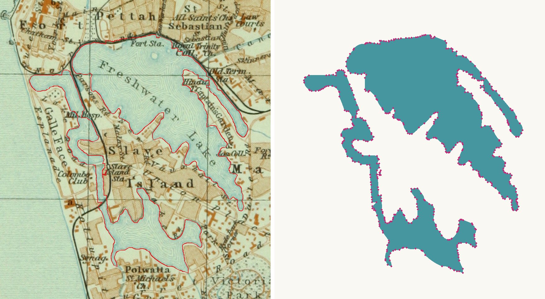
Baedeker's 1914 handbook for India has a 1:50,000 map of Colombo by Wagner & Debes. The lake in the middle of the city is printed in flat blue-green and labelled "Freshwater Lake". Today it is called Beira Lake. OpenHistoricalMap did not have the lake for any year, so we traced the 1914 outline and added it to OpenHistoricalMap.
How it was made
- Cut the lake area out of the scan (580 × 640 px) and kept only the water colour. Lettering and the fine shore lines printed over the water were filled in.
- Two places were painted in by hand: the strip of water under the words "Fort Sta." on the north shore, and the narrow channel beside the railway that joins the west arm to the southern lake. Two other places where the map does not make clear whether it is land or water were left as they were.
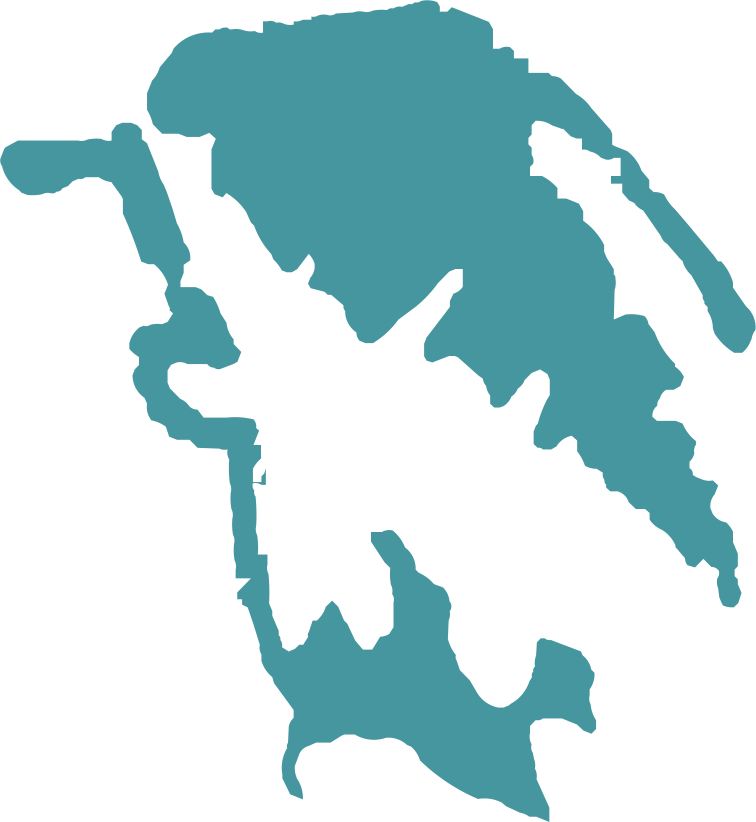
- Traced the result with our vector engine: 2 closed shapes, 549 nodes (357 straight segments, 192 arcs). The outline sits on average 0.2 map pixels from the edge of the colour mask, about 0.9 m at the map's scale.
- Placed the outline on today's coordinates using three railway stations that are on the 1914 map and are still stations today: Kollupitiya, Slave Island (now Kompannavidiya) and Maradana. One scale-and-shift fit gives 4.54 m per map pixel, with 37 to 71 m left over at the stations.
- Checked it over satellite imagery. Where the 1914 shore still exists, the outline is within 10 to 30 m of it.
- Drew the two areas by hand, following the outline simplified to a 12 m tolerance.
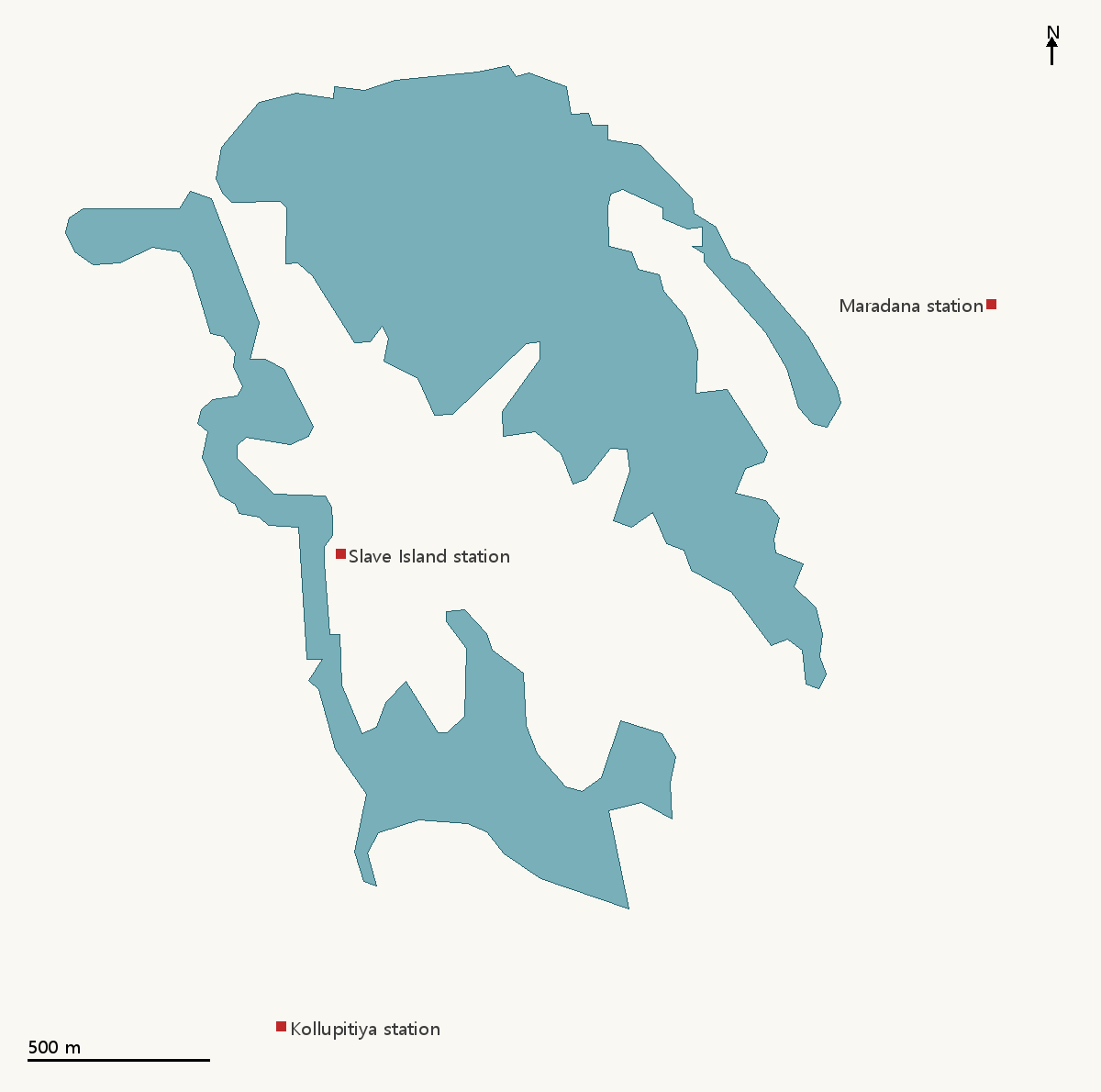
| Main lake | West arm and southern lake | |
|---|---|---|
| OpenHistoricalMap way | 205434294 | 205434295 |
| Nodes | 105 | 92 |
| Area | 113.3 ha | 52.5 ha |
| Dated | 1914 | 1914 |
Both areas are tagged with the map's year only. We have no source for when the lake first took this shape or when it changed, so the dates say no more than "as in 1914". The note on each area says it is the map's drawing of the lake, not a survey of the shore, and that the placement can be off by about 50 m.
Compared with the satellite image, the narrow arm in the north-east and the eastern part of the southern lake appear to be land now.
The files are free to use. The SVG and DXF are in map units, 200 mm wide. The GeoJSON holds the two areas as uploaded, in longitude and latitude.
- The two areas in OpenHistoricalMap, changeset 281497
- Main lake on OpenHistoricalMap (way 205434294)
- West arm and southern lake on OpenHistoricalMap (way 205434295)
- The 1914 map on Wikimedia Commons